Google AI satellite to map methane emissions
Air pollution is one of the problems that we’re still tackling after years of climate measures.
When facing huge problems, most would think of stepping back and looking at the “big picture.” In other words, we need an overview of the overarching issues to find a solution. Coincidentally, Google and a non-profit organization had the same idea for beating methane emissions.
The search engine company and the Environmental Defense Fund (EDF) are developing the MethaneSAT mission. It involves launching a satellite that will illustrate methane leaks from oil and gas operations worldwide. In other words, their upcoming satellite will give us “Google Maps for methane emissions” to give us a better understanding of air pollution.
Let’s see how this Google AI satellite will track global methane concentrations. This writer will also discuss a phenomenon illustrating how severe the air pollution problem has become.
How does the Google AI satellite work?
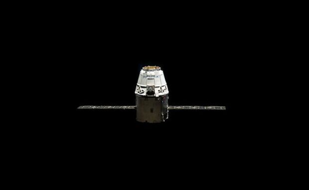
PopSci reports that MethaneSAT is an AI-enhanced satellite that will track and quantify dangerous emissions to offer info to researchers worldwide. Once in orbit, its software and spectrometers will measure light wavelengths to detect methane.
MIT Technology Review says it will pinpoint concentrated regions of methane plumes and wider areas where gases spread and diffuse. Moreover, it will use Google’s image detection algorithms to produce the first comprehensive global map of the gas and oil industry’s infrastructure.
“Once those maps are lined up, we expect people will be able to have a far better understanding of the types of machinery that contribute most to methane leaks,” says Yael Maguire, Google’s geosustainability leader.
Rob Jackson, an earth science professor at Stanford, says the Google AI satellite could solve a significant problem for methane researchers. Many oil and gas operations produce methane, which is responsible for roughly a third of global warming due to greenhouse gases.
However, these facilities are difficult to access. Some have tight security and others charge expensive access fees. Also, some countries prevent researchers from checking their infrastructure.
READ: China drills for ‘flammable ice’
“I think AI is the future of this field, where we should be creating databases of all these infrastructure types,” says Jackson. That’s because measuring plumes from space sidesteps much of the oil and gas industry’s opaqueness on Earth. “One door that satellites are unlocking is the ability to peer everywhere. There will be nowhere to hide, eventually.”
After MethaneSAT detects methane leaks, EDF will submit the information to the global Methane Alert and Response System from the United Nations.
Jackson is optimistic about the Google AI satellite but admits going from awareness to action can be difficult. One issue is identifying the exact infrastructures that could be causing such emissions. Also, some countries are likely to ignore climate data.
How severe is global warming nowadays?
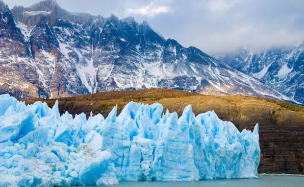
Methane emissions worsen as it exacerbates global warming. A previous Inquirer Tech article explains one of the reasons: methane trapped in arctic ice.
Thomas Birchall of the University Center’s Department of Arctic Geology discovered that Norway’s Svalbard islands contain several million cubic meters of methane and other greenhouse gases.
They also discovered that the permafrost is rapidly melting as global warming worsens. Soon, these ice caps may melt and release methane gas that will exacerbate climate change.
“Svalbard shares a similar geological and glacial history with much of the Circum-Arctic, suggesting that sub-permafrost gas accumulations are regionally common,” Birchall and his colleagues wrote in their paper.
He also found that gas accumulations at 18 hydrocarbon exploration wells were higher than expected. “All the wells that encountered gas accumulations did so by coincidence,” Birchall said.
“[B]y contrast, hydrocarbon exploration wells that specifically target accumulations in more typical settings had a success rate far below 50%.”
Birchall said drillers near the Longyearbyen airport heard a bubbling sound from their well. In response, they examined the location to confirm explosive levels of methane. Birchall said the team’s alarms “were immediately triggered when we held them over the wellbore.”