
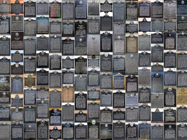
MANILA, Philippines – Since 2004, the month of May has been celebrated in the country as the National Heritage Month. President Gloria Macapagal Arroyo signed Proclamation No. 439 in order to strengthen Filipinos’ awareness of cultural heritage sites, structures and landscapes, and to encourage their participation in the preservation of these cultural legacies.
Now the heritage space in the country is not well-known for its technological activities. Aside from things like modern techniques and tools for restoring centuries-old artifacts or church façades, or even the National Museum recently launching its Museo Guide mobile app, you rarely hear of cultural heritage organizations and their digital innovations.
To be fair, information technology is not the responsibility of the National Museum, the National Historical Commission, or the National Commission for Culture and the Arts. I would much prefer the NHCP to use its expertise to research where the first Mass was held in the Philippines (it’s in Limasawa and not Butuan) or when the Philippine flag was first unveiled by Gen. Aguinaldo (it’s in Cavite City and not Imus).
RELATED STORY: Bulacan landmark gets colorful makeover ahead of int’l art festival
As is often the case, it is left to civil society and other private sector organizations to help in the digital documentation and preservation of the Philippines’ cultural heritage. Before May ends, let me talk about the 10-year-old project that I and others in the heritage sector have been doing to document national historical markers.
Bite-sized history, on location
Historical markers, also known as commemorative plaques, are plates made of metal, stone, or wood placed in permanent places and bearing historical text that often states the significance of the marked place in history. The first modern program for installing these plaques and markers started in England in the 19th century and other countries subsequently initiated their own programs.
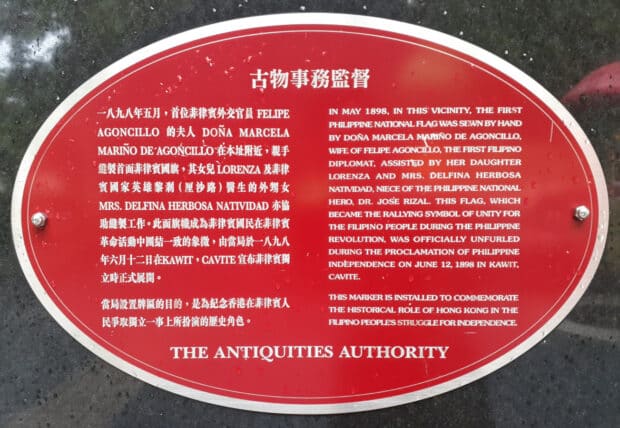
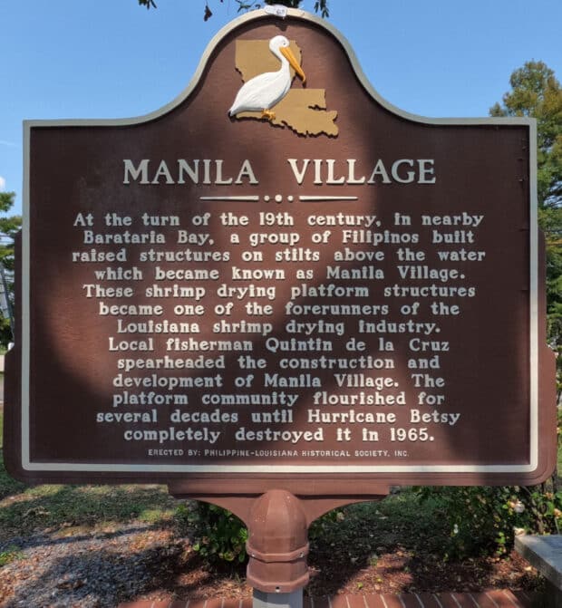
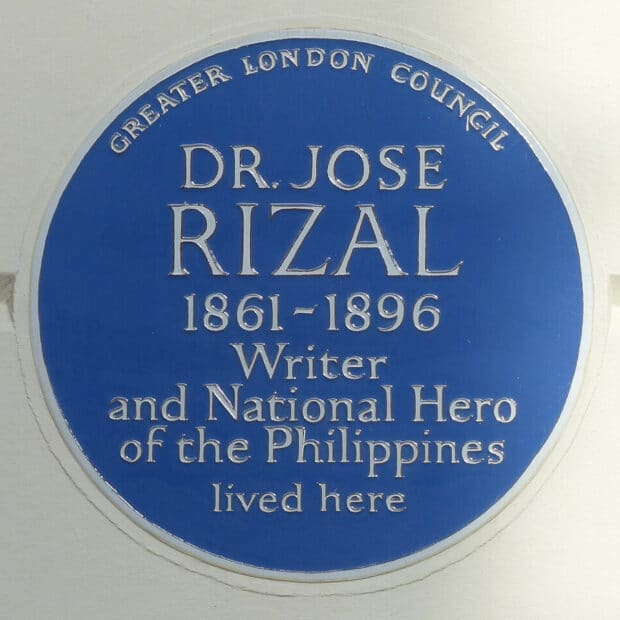
Philippine-related plaques and markers outside the Philippines: Greater London Council blue plaque marking the place where José Rizal lived in London, United Kingdom (photo by User:Megalit, CC BY-SA 4.0); Manila Village historical marker commemorating the main Filipino settlement in Louisiana, United States (photo by Ervin Malicdem, CC BY-SA 4.0); Philippine flag plaque marking the site where the first Philippine flag was sewn by Marcela Agoncillo in Hong Kong (photo by Zchim Rengko 52 Yuea, CC BY-SA 4.0).
The Americans brought the idea of creating historical markers to the Philippines when the Historical Research and Markers Committee was created in 1933. The first historical markers, made of cast iron, were installed in various places in Manila in 1934 and the committee eventually became the current National Historical Commission of the Philippines. The NHCP is still continuing the nearly-century-old tradition of placing historical markers to commemorate significant people, places, and events in Philippine history.
Incomplete records and lack of discoverability
How many Philippine historical markers are there? Unfortunately, we do not know. Due to a lack of rigorous record-keeping, changing administrations, and damage and neglect—many markers were destroyed or lost during World War II—we don’t know the total number of markers, much less their status and where they are. Based on various marker lists Wikipedia estimates that over 1,800 markers have been issued, but of course this is not a definitive count.
RELATED STORY: This week’s milestones: May 24 to May 30
Another problem is that it is not easy to discover these markers and visit them based on information that the NHCP provides. The commission maintains two websites, both called the National Registry of Historic Sites And Structures. One is hosted under the NHCP’s domain name, and the other uses Google’s Blogger service as its host. Unfortunately, the first appears to have not been updated since 2023 and the latter, while more up-to-date, is still incomplete and not very user-friendly.
Historical Markers Map
Since 2016, my colleagues at the Wiki Society of the Philippines and I, along with other like-minded volunteers, have been documenting NHCP’s historical markers in Wikidata and Wikimedia Commons, two of Wikipedia’s sister projects. (You can think of Wikidata as a structured database companion to Wikipedia, while Commons is a multimedia repository hosting over 140 million photos and files.)
For each historical marker that we know of, we create a record in Wikidata and add information on its address and geographic coordinates, its inscription, when it was installed or unveiled, and which person, place, or event is being commemorated. We then upload photos of these markers and their surroundings to Commons.

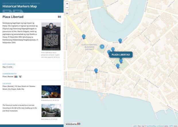
Because Wikidata and Commons have APIs (application programming interfaces) that apps can use to query data and photos, we created the Historical Markers Map to provide a user-friendly interactive map showing all of the extant historical markers that we have researched. The map aspect is not happenstance because when viewed collectively, historical markers form a geographic record of how the nation remembers its past, tying locales and places to the strands of history.
(Trivia: Did you know that there are 25 historical markers outside the Philippines? Most of them commemorate José Rizal and several were placed where Rizal stayed during his travels to Europe and North America.)
We encourage Filipinos and history buffs to help us continue documenting these historical markers. We especially welcome photos of historical markers because many markers still lack photos in Commons.
Preserving Philippine history is more than an academic exercise—it ensures that future generations understand the people, places, and events that shaped the nation. As Rizal mentioned in his play El Consejo de los Dioses, “con el recuerdo del pasado, entro en el porvenir” (“I enter the future with a memory of the past”).