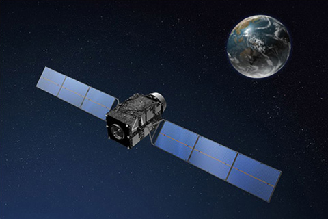
Image: Japan Aerospace Exploration Agency official global website
Japan successfully launched its fourth quasi-zenith positioning satellite, placing it in orbit.
This satellite series was designated as the Michibiki, with its fourth satellite launched from the Tanegashima Space Center in Kagoshima prefecture on a H-IIA rocket. The first Michibiki satellite was launched in September 2010.
According to The Japan Times, the Japanese government plans to start supplying positional data gathered by the four Michibiki satellites by fiscal year 2018. These four will move almost directly above Japan.
Global Positioning System data from the Michibiki satellites will be used in a self-driving bus experiment scheduled for November.
“We’re planning to conduct in November an experiment on a self-driving bus utilizing the Michibiki system on the main island of Okinawa,” said Go Takizawa, executive director of the Quasi-Zenith Satellite System Strategy Office at the Cabinet Office’s National Space Policy Secretariat.
The Michibiki system was built to compliment GPS. It would help to increase accuracy, enhancing navigation capabilities through satellite positioning data.
Other applications for the enhanced satellite positioning performance include tourism navigation which combines augmented reality technology with GPS data from the satellites.
The Japanese government plans to have up to seven Michibiki satellites released in orbit by 2023. Doing so would allow the system to operate independently of GPS. Alfred Bayle/JB
RELATED STORIES:
WATCH: Dubai cops may add hoverbikes to collection of high tech tools
Giant robots from Japan, US all set for epic battle
NASA calls on everyone to send names to Mars, earn frequent flyer points