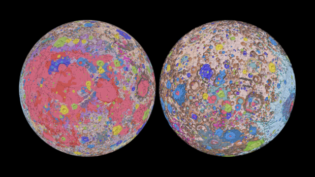
This geologic map is a synthesis of six Apollo-era regional geologic maps, updated based on data from recent satellite missions. Image: NASA/GSFC/USGS
The first comprehensive geologic map of the moon that shows its surface in “incredible detail” was released by scientists from the United States Geology Survey (USGS) Astrogeology Science Center.
The map, dubbed the “Unified Geologic Map of the Moon,” was created with researchers from NASA and the Lunar Planetary Institute, as per a USGS statement on April 20.
The scientists pointed out that it will serve as the “definitive blueprint of the moon’s surface geology” for future missions, showing its exterior at a 1:5,000,000 scale. The center also said that the map will be “invaluable” to the public-at-large and the international scientific community.
The team created the map using information from six “Apollo-era” regional maps, referring to the Project Apollo human spaceflight program by NASA from 1961 to 1972.
Researchers also used updated information from recent satellite missions to the moon to complete the map. Among the included missions was the Selenological and Engineering Explorer mission led by the Japan Aerospace Exploration Agency.
The existing maps were then redrawn to align them with modern data sets to preserve previous findings. It was also supplemented with data from NASA’s Lunar Orbiter Laser Altimeter.
“This map is a culmination of a decades-long project,” USGS geologist and lead author Corey Fortezzo said. “It provides vital information for new scientific studies by connecting the exploration of specific sites on the moon with the rest of the lunar surface.”
Besides the map, the team also produced a “unified description” of the rock layers of the moon, which resolved inconsistent information in previous maps. /ra
RELATED STORIES:
NASA launches website with at-home activities amid quarantine
LOOK: NASA creates logo to celebrate women on moon